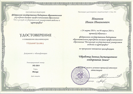
In-Depth ERS Data Processing Technology. ScanEx Image Processor Software: Training Course Program
The course is aimed at teaching students thematic interpretation of remote sensing data, methods for choosing tools and algorithms for thematic processing. In the learning process, methods of visual-interactive decoding and automated image classification algorithms are considered. Students will gain skills in working with such methods of automated processing as: unsupervised classification, supervised classification and building standards for its training, segmentation of spectral-zonal space images, neural network analysis of space images using Kohonen's self-organizing neural networks; get acquainted with the algorithms of improving transformations, etc. During the training, the “Thematic Pro” module of the ScanEx Image Processor® program is used
10:00 — 18:00
Day 1 Theoretical part
Individual assignments;
Students’ questions and answers;
The award of certificates to acknowledge the successful completion of the “Art of Thematic Interpretation” training course.
10:00 — 18:00
Day 1 Practical part
General description of ScanEx Image Processor software (purpose, specific features, main formats supported, software interface);
Getting started (downloading data in the software, changing projection and project file resolution, working windows and navigation tools, operations with imagery, operations with histograms, saving processing results in a file);
Operations with vector layers (downloading vector layers in the software, creating and editing vector objects, selecting a display option for object captions, creating a new vector layer, adding and viewing the attribute data of vector layers), automatic vectorization.
10:00 — 18:00
Day 2 Theoretical part
Basic principles of image generation by modern imaging systems;
Geometric and radiometric properties of imagery;
Basic approaches to correcting the geometric distortions of different imagery types, with account of imaging equipment specifics and local relief;
Digital elevation models (DEMs).
10:00 — 18:00
Day 2 Practical part
Creation of a raster data library and importing data therefrom;
Geometrical correction: georeferencing based on a strict sensor model;
Batch download of publicly available DEMs (GTOPO-30, SRTM-30 etc.);
Orthotransformation;
RPC-based geometrical correction.
10:00 — 18:00
Day 3 Practical part
Automatic co-registration of imagery;
Creation of mosaic coverages;
Bundle adjustment;
Creation of mosaic coverage with automatic tonal balancing and automatic cutline generation.
10:00 — 18:00
Day 4 Theoretical part
Determination of reflectance and atmospheric correction methods offered by SIP;
Enhancements, spectral transformations;
Topographic correction;
Index-based imagery.
10:00 — 18:00
Day 4 Practical part
Improvement of spatial resolution (Image Fusion operation);
Synthesis of green and blue channels (for data without any blue elements);
Haze compensation in multispectral imagery;
Analysis of temporal variations in spatial objects (Change Detection);
Determination of reflectance and atmospheric correction;
Arithmetic operations with raster layers, creation of macros;
Operations with index-based imagery (creation, visualization).
10:00 — 18:00
Day 5 Theoretical part
Terra/Aqua MODIS data;
Fundamentals of imagery classification;
Methods of creating digital elevation models (DEMs) and digital terrain models (DTMs).
10:00 — 18:00
Day 5 Practical part
Download of thematic products based on Terra/Aqua MODIS data;
Unsupervised imagery classification (Isodata), operations with a raster legend;
Introduction to Landscape 3D module;
Additionally: creation of a digital terrain model (DTM) based on highly detailed stereoscopic imagery;
Additionally: georeferencing a raster map (operations with ground control points, polynomial transformation).

